
The surveying Lab is a well- established laboratory that is equipped with almost all surveying Instruments needed for the students to apply the principles taught in the theoretical Surveying courses. The Surveying Lab is supporting courses of Civil Engineering program [Plane Surveying 1401270, Applications of Surveying and Mapping 1401271, B.Sc. Projects 1401491 and 1401492] of Engineering College. The Surveying Lab contains many different instruments, equipment and tools inside the laboratory as shown in Table [1-1]. In order to keep the surveying lab up to date, new important instruments were joined (March-2023) to the surveying lab [(1) of GNSS package (Topcon HIPER-VR) and (2) of Total Station (Topcon OS-201)]. The laboratory experiments include training students to measure (lengths), (horizontal and vertical angles), (make longitudinal), (areas), (transverse), (grid budgets to measure the elevations of different points) and (get points coordinates) by different instruments and techniques. Undergraduate students use this lab as an integral part of their surveying coursework and obtain topographic information that can help their capstone design projects, such as highway design and land development. Students also learn safety and instruction on the field work, the use and care of the surveying Instruments, Equipment and Tools.
Contents of surveying Lab.
Number | Instruments, Equipment and Tools | # |
|---|---|---|
1 | GNSS package (Topcon HIPER-VR), with accessories. [Date_15-3-2023] | 1 |
2 | Total station instruments (Topcon OS-201), Adjustable Leg Tripod and Reflectors. [Date_15-3-2023] | 2 |
2 | Total station instruments (Leica), Adjustable Leg Tripod and Reflectors. | 3 |
4 | Digital theodolite instruments and Adjustable Leg Tripod. | 4 |
5 | Automatic level instruments and Adjustable Leg Tripods. | 5 |
2 | Laser level instruments. | 6 |
2 | Digital level instruments. | 7 |
20 | Aluminum staff. | 8 |
15 | Digital planimeter. | 9 |
2 | Surveying compass | 10 |
5 | Brunton compass | 11 |
25 | Ranging rods | 12 |
4 | Square optical prism | 13 |
3 | Steel measuring tape (50 m) | 14 |
3 | Fiberglass tape (50 m) | 15 |
5 | Steel measuring tape (30 m) | 16 |
4 | Fiberglass tape (30 m) | 17 |
3 | Steel measuring tape (5 m) | 18 |
3 | Digital distance measuring | 19 |
49 | Arrows | 20 |
3 | Wooden mallet | 21 |
46 | Survey pegs (Consumer) | 22 |
2 | Spirit level (big) architect | 23 |
10 | Ground plate for staff | 24 |
100 | Bolts (Consumer) | 25 |
4 | Color Spray (Consumer) | 26 |
3 | Spirit level (small) architect | 27 |
|
|
Photo Gallery
Image 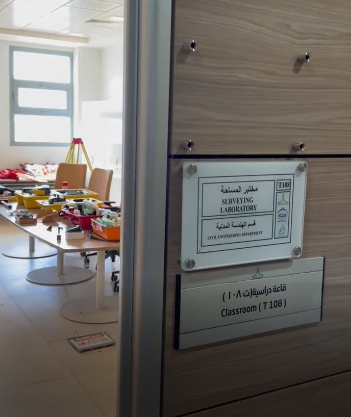 | Image 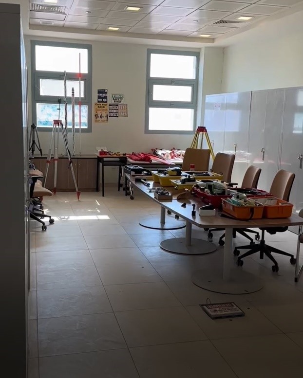
| ||
Surveying lab (Different Instruments, Equipment and Tools of surveying lab) | |||
Image 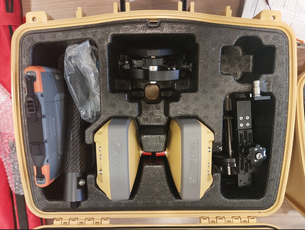
| Image 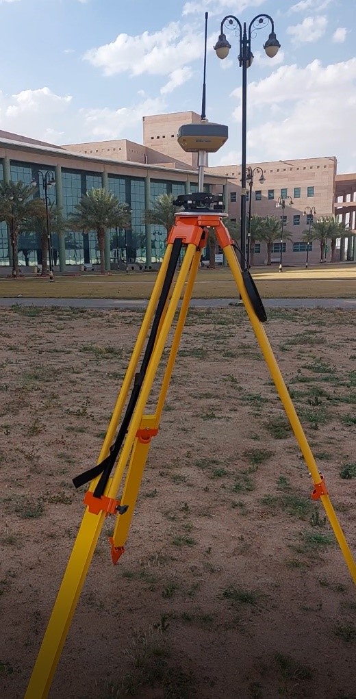 Topcon )HIPER-VR) instrument | ||
GNSS package (Topcon HIPER-VR) with all accessories Global Navigation Satellite System (GNSS) is a constellation of satellites providing signals from space that transmit positioning and timing data to GNSS receivers. The receivers then use this data to determine location. GNSS provides global coverage. Examples of GNSS include; 1- Europe’s Galileo 2- the USA’s NAVSTAR Global Positioning System (GPS) 3- Russia’s Global'naya Navigatsionnaya Sputnikovaya Sistema (GLONASS). 4- China’s BeiDou Navigation Satellite System. | |||
Image 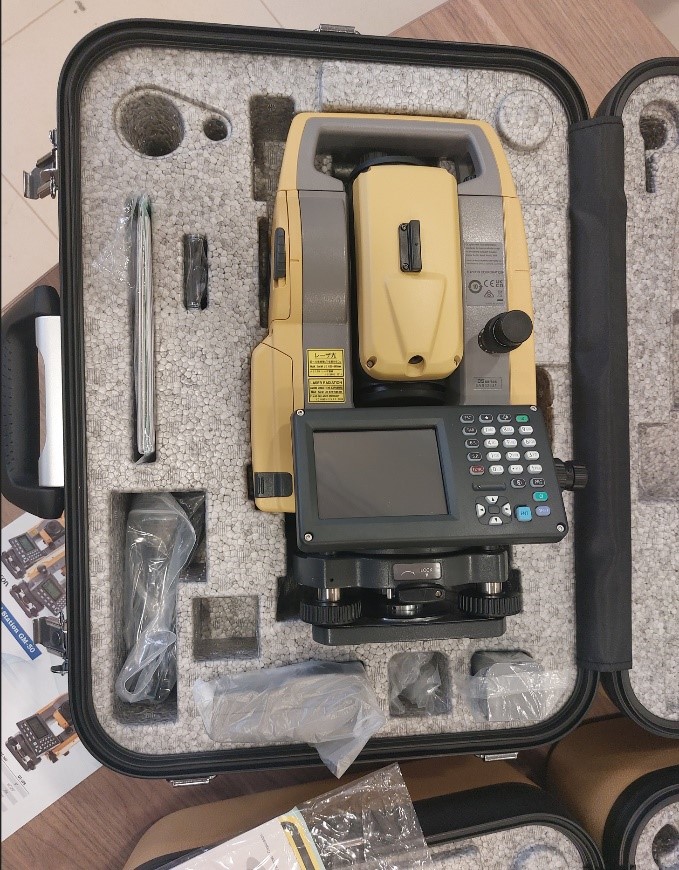 |
Image 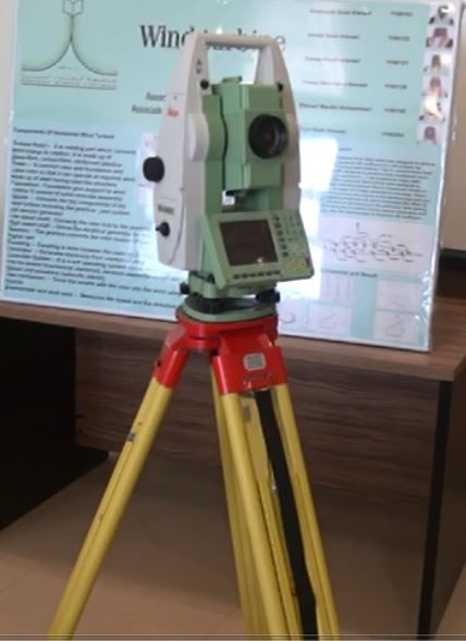
| ||
| Total station (Topcon OS-201) instrument | Total station (Leica TCR1201+) instrument | ||
Total station is a combination of an electronic Theodolite instrument [which is used to measure horizontal and vertical angles] with an Electronic Distance Meter (EDM) instrument [which is used to measure distances electronically] in one unit. Using these observed data about each point, the data processor inside the Total station instrument can directly calculate the three-dimensional coordinates of each point, and the device can also measure and calculate the slopes. The Total station is also used in all Surveying and Sitting-out operations in the field. Also This instrument has a large internal memory to store field data and can be uploaded directly to the computer from the device via the interface cable. | |||
Image  | Image 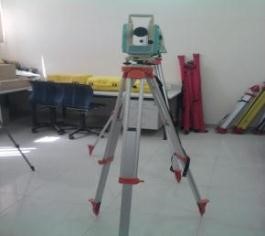 | ||
Digital Theodolite instrument and Adjustable Leg Tripod | |||
| Electronic Theodolite instrument is used to measure horizontal and vertical angles mainly and directly. | |||
Image 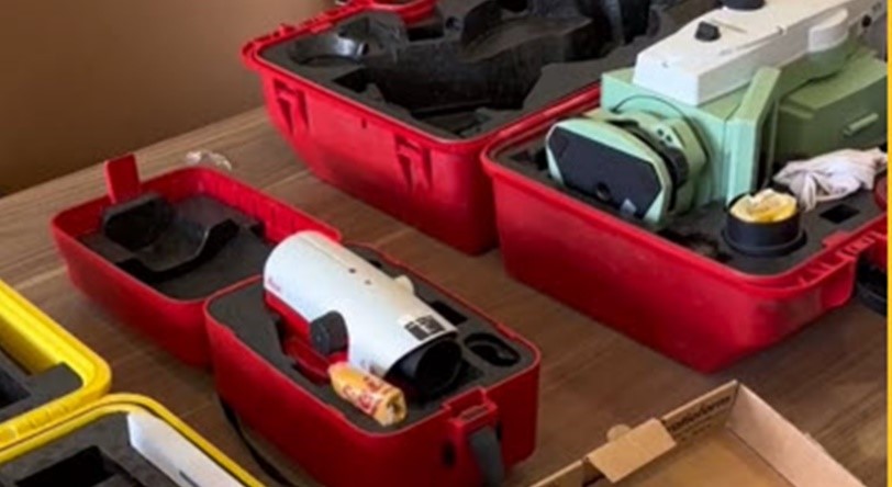 Image 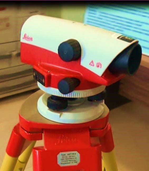 | Image 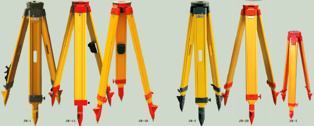 Image 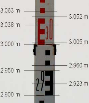 Image 
| ||
Automatic level (Leica NA720) instruments | Adjustable Leg Tripod and leveling staff | ||
Electronic Theodolite instrument is used to measure horizontal and vertical angles mainly and directly. | |||
Image 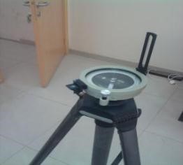 | Image 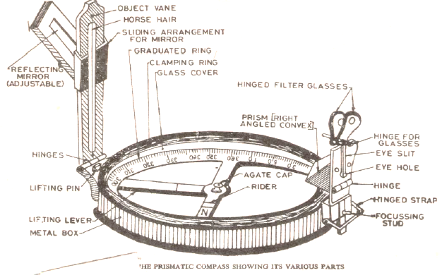 | ||
Prismatic compass and Adjustable Leg Tripod
Used to measurement of bearings of sides of traverse with prismatic compass and computation of correct included angle mainly and directly.
| |||
Image  | Image 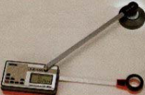 | ||
Digital planimeter | |||
The planimeter is used to measure the areas of irregular shapes (polygon), whether their boundaries are straight lines or curved boundaries, from cadastral maps. This method is classified as one of the mechanical methods for finding the areas of shapes. | |||
Image 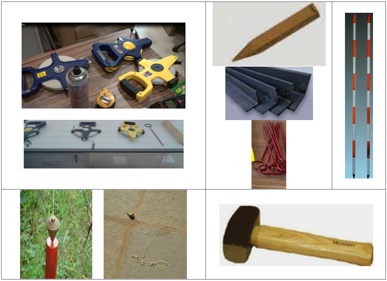 | Image 
| ||
Longitudinal measurement tools [Tapes, Digital Tapes, Arrows, Ranging Rods, Cross staff or optical square, Plumb bob, Wooden mallet (Hammer), Bolts, Survey pegs, Marker.]
To measure a distance by tapes and also to survey a selected area using longitudinal measurement tools only.
| |||
| Image  | ||